Read the water in one clear timeline.
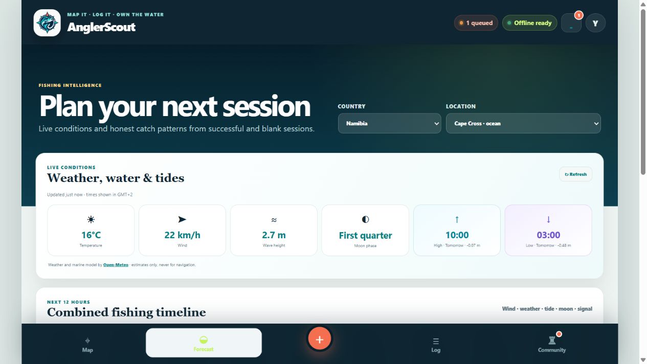
See location-based tides, wind, waves, weather, daylight and moon phase together—then compare conditions with your own fishing history without pretending a score can guarantee a catch.
Open AnglerScout →
Stop checking five separate places.
AnglerScout brings the conditions anglers normally compare into one location-specific view. The goal is quicker understanding—not false certainty.
High and low tides
See tide times in the local time of the selected fishing location, plus whether the tide is rising or falling.
Wind and waves
Compare direction, speed and wave height with the type of water and method you plan to fish.
Moon and daylight
View moon phase, sunrise, sunset and the changing light windows around a session.
A conditions score—not a catch guarantee.
An 87% score means the selected weather, wind, waves, tide movement, daylight and moon conditions align strongly with the current model. It does not mean there is an 87% chance of catching a fish.
Species, water type, fishing pressure, technique, bait and countless local factors still matter. AnglerScout labels the score clearly so anglers can use it as one planning signal.
Successful catches and blank sessions both matter.
Future probability signals can compare anonymised records against tide stage, weather, season and time. Recording a session with no catch prevents the model from learning only from successful outings.
- Analyse by species and location area
- Compare seasonal and time-of-day patterns
- Include blank sessions for a less biased picture
- Protect private coordinates in aggregated results
Safety comes before a score
Forecasts and tide data can be delayed, incomplete or wrong. Always check official marine, weather and emergency sources before going onto the water.
Read the AnglerScout safety notice →Ready to scout your next session?
Explore the AnglerScout app or continue through the detailed feature pages.